Sonora
| Sonora Estado Libre y Soberano de Sonora |
|||
|---|---|---|---|
| — State — | |||
|
|||
 |
|||
 |
|||
| Coordinates: | |||
| Country | |||
| Capital | Hermosillo | ||
| Municipalities | 72 | ||
| Admission | January 10, 1824[1] | ||
| Order | 12th[a] | ||
| Government | |||
| - Governor | Guillermo Padrés Elías (PAN) | ||
| - Federal Deputies | PAN: 1 PRI: 6 |
||
| - Federal Senators | PAN: 2 PRI: 1 |
||
| Area Ranked 2nd |
|||
| - Total | 182,052 km2 (70,290.7 sq mi) | ||
| Population (2009) | |||
| - Total | 2,499,263 (Ranked 17th) | ||
| Time zone | MST (UTC-7) | ||
| HDI | 0.8580 - high Ranked 5th |
||
| ISO 3166-2 | MX-SON | ||
| Postal abbr. | Son. | ||
| Website | Sonora State Government | ||
| ^ a) Joined to the federation under the name of Estado de Occidente (Western State) also recognized as Sonora y Sinaloa. | |||
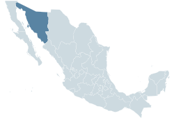
Sonora (Spanish pronunciation: [soˈnoɾa]) is a state in northwestern Mexico with an area of 182,052 square kilometers (70,291 sq mi), making it around the size of Syria. It is surrounded by the states of Baja California and the Sea of Cortez to the west, Chihuahua to the east, Sinaloa to the south, and the US states of Arizona and New Mexico to the north.
The capital is Hermosillo; other important cities include Ciudad Obregón and Nogales.
Contents |
History
Pre-contact era
The archeological evidence suggests that Sonora area of Mesoamerica had permanent Paleo-Indian settlements as far back as 1500 BC. in the Sonoran Desert. The largest known indigenous cultures were of the Yaqui and the Mayo peoples. They flourished around AD 1300 and established settled agricultural communities. Both groups defended their communities and territories against nomadic tribes who traveled through their region. The Yaqui people inhabited the eastern part of Sonora near Mar de Cortés. The Mayo tribe lived primarily in the southern part of the state and established an important cultural center in what is now the city of Guaymas.
Spanish era
In 1531, Spanish conquistador Nuño Beltrán de Guzmán founded the city of San Miguel de Culiacán in the region that would eventually become Sinaloa and Sonora. Using the city as a central base, the Spanish launched excursions throughout the area to locate mineral deposits and establish new colonies.
Conquistador Diego Guzmán entered what is now Sonora in 1533. Encountering resistance from combined Yaqui and Mayo forces, he quickly abandoned the region. In 1536, Spanish explorer Álvar Núñez Cabeza de Vaca and three companions passed through the region on foot in search of new wealth for Spain.
In 1599, Captain Diego de Hurdaide established San Felipe y Santiago on the site of the modern city of Sinaloa and launched a military campaign that subjugated many indigenous tribes, including the Sinaloa, Tehueco, Zuaque and Ahome people. In the 1687 the Jesuit missionaries, led by Father Eusebio Francisco Kino, arrived in the Pimería Alta (upper land of the Pimas) and were given the responsibility to establish the Spanish missions in the Sonoran Desert. The missions were to convert in reductions the indigenous residents to Roman Catholicism and encouraged the assimilation of Spanish culture. However, clashes between the Spanish and the Yaquí and other tribes continued throughout the 17th century.
Mexican Independence
During the early 1800s, the people of Sonora enthusiastically supported Mexico’s independence movement, although many landowners were more concerned about protecting their land from local Indians. The territory that was to become Sonora and Sinaloa was incorporated into independent Mexico as a single constituent state, Sonora y Sinaloa, under the Constitution of 1824. In September 1830, that state was divided and became modern Sonora and Sinaloa.
As Mexican politics became chaotic during the latter part of the 19th century, Sonora was for a time caught in the middle. Political instability and U.S. expansionist policies led to war between Mexico and the US in 1846; Sonora was occupied by foreign troops in 1847. The Treaty of Guadalupe-Hidalgo brought an end to the Mexican-American war in 1848. Sonora was again a free state, bordering the New Mexico Territory of the U.S.
During the closing years of the 19th century, the Yaqui and Mayo Indians in Sonora began to protest mistreatment and marginalization by the government, and demanded autonomy and equal rights. Irritated by their demands, President Porfirio Díaz initiated a war against the groups; his forces killed thousands and deported many others. The few Yaqui who remained in the region were protected by ranch owners.
When the Mexican Revolution began in November 1910, many Sonorans, including the remaining Yaqui and Mayo, rose up against and helped overthrow the dictatorial Díaz. Sonora native Álvaro Obregón recruited the Yaqui into his Army of the Northwest. Obregón was the first Constitutional Army general to enter Mexico City after the resignation of Victoriano Huerta; he decisively defeated Pancho Villa at the Battle of Celaya in 1915. In 1920 Obregón overthrew Venustiano Carranza, the premier jefe of the revolution, after he had refused to name Obregón his successor as President.
Obregón, his successor Plutarco Elias Calles, and the clique who surrounded them were known as the 'Sonora gang'. Both leaders came from the petit-bourgeoisie of enterprising farmers and professionals of Mexico's northernmost and (in many respects) most economically advanced state.[2] Their ideology was defined by the anti-clericalism common on Mexico's northern frontier, and a disinterest in Emiliano Zapata's program of land reform, "focusing on economic progress promoted by the State, oriented towards private property, antireligious, and bordering, at moments, on Fascism."[3]
From the late 1800s to the 1930s, a significant number of Chinese immigrants settled in Sonora until anti-Chinese sentiment here and in other parts of Mexico lead to their mass deportation in the 1930s.[4]
Geography

Sonora's western shores border the Sea of Cortez (or Gulf of California, as it is also known), which is connected to the Pacific Ocean further south. Sonora is thus linked to the "Pacific Rim". Through the port of Guaymas, it has opportunities for economic development and faces challenges and opportunities for sustainable use of its natural resources. The Sonoran coastline is 1,208 kilometers (751 mi) long.
Sonora borders the state of Chihuahua to the east, Sinaloa to the south and Baja California to the northwest; to the north it shares an extensive border with the U.S. state of Arizona and a shorter one with New Mexico. To its west lies the Gulf of California; the state of Baja California Sur also shares a maritime boundary with Sonora.
The border with Chihuahua is 592 km (368 mi) long, and the border with Sinaloa is 117 km (73 mi) long. Sonora's border with Arizona is 568 km (353 mi) long, and its border with New Mexico is 20 km (12 mi) long; these borders allow for multiple economic, cultural, and political ties with the United States. The state's total perimeter is 2,505 km (1,557 mi). Sonora is the second largest state in Mexico (184,934 km2 (71,403 sq mi)), representing 9.2% of the nation's total area.
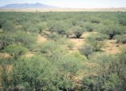
Sonora consists of four physiographic regions: The Sierra Madre Occidental, Parallel Mountains and Valleys, the Sonoran Desert, and the Coast of the Gulf of California. Sonora is located in a climactic strip in the northern hemisphere that has formed various deserts around the globe. The state is located at the same latitude as the deserts of North Africa, the Arabian Peninsula, and other regions.
Climate
Extreme high temperatures of 50 °C (122 °F) or higher occur in summer in desert areas while winters, although short, are cool compared with most of Mexico. Most parts of Sonora are located in the desert. Sonora has a climate like Saudi Arabia or United Arab Emirates which are at similar latitudes. Sonora is extremely arid. Some cities like Nogales and Cananea are less hot in summer and with cold winters because they are at an altitude of 1,500 meters (4,900 ft) or more, on the other hand cities like Hermosillo and Ciudad Obregón are extremely hot in summer and mild to warm in winter because they are at an altitude of 20 m (66 ft) or less.
Population
In 2000, Sonora had 2,216,969 inhabitants, of whom 50.1% were men and 49.9% were women; this represented 2.3% of Mexico's total population. Population growth has been steady, with an increase of over 700,000 people between 1980 and 2000. As of 2000[update], there were 271,277 children under 5 years of age, 474,481 children aged between 5 and 14 years, 422,588 between 15 and 24 years 740,930 between 25 and 49 years, and 307,693 adults 50 years and older.
According to the last official national census that counted the racial component (1921), 48.84% of the population was white, 40.38% was mestizo, and 11.78% was indigenous.
The most populated municipalities in Sonora are:[5]
- Hermosillo 701,837
- Ciudad Obregón 375,800
- Nogales 193,517
- San Luis Río Colorado 157,076
- Navojoa 144,598
- Guaymas 134,153
Government
The government of Sonora is divided into three branches: executive, legislative, and judicial.
The executive branch consists of a governor elected by direct vote every six years without the possibility of re-election. The current governor of Sonora is Guillermo Padrés Elías (PAN).
The legislative branch consists of a unicameral legislature composed of 21 deputies elected directly and 12 deputies selected by proportional representation for a period of three years with no possibility of re-election.
The judicial branch of the state of Sonora is composed of seven judges. Currently Lic. Max Gutiérrez Cohen is the President of the Supreme Court of Justice of the State.
Education
The last census, dating back to the year 2005, reveals that 55% of the state population is younger than 30 years of age; those over 15 years have in average finished secondary school which implies a schooling rate of almost 9 years; and 4% of that same portion over 15 years of age are illiterate, way below the national average of 8%.
Institutions of higher education
For decades the main institution of higher education has been the University of Sonora or UNISON, whose main campus is located in Hermosillo, with satellite campuses in Navojoa, Caborca, Santa Ana, and Nogales. UNISON is currently one of the biggest public institutions of higher education in Mexico.
In recent years a number of new public and private universities have opened.
- Centro de Estudios Superiores del Estado de Sonora (CESUES) Campus Hermosillo
- Centro de Estudios Superiores del Estado de Sonora (CESUES) Campus Navojoa
- Escuela Normal del Estado (ENES)[6]
- Instituto Tecnológico de Sonora (ITSON) Ciudad Obregón (main campus)
- Instituto Tecnológico de Sonora (ITSON) Unidad Empalme
- Instituto Tecnológico de Sonora (ITSON) Unidad Guaymas
- Instituto Tecnológico de Sonora (ITSON) Unidad Navojoa
- Instituto Tecnológico de Hermosillo (ITH)
- Instituto Tecnológico de Nogales (ITN)
- Instituto Tecnológico Superior de Cajeme (ITESCA)
- Instituto Tecnológico Superior de Cananea (ITESCAN)
- Instituto Tecnologico Superior de Puerto Peñasco (ITSPP)
- Instituto Tecnológico y de Estudios Superiores de Monterrey (ITESM-COB) Campus Ciudad Obregón
- Instituto Tecnológico y de Estudios Superiores de Monterrey (ITESM-CSN) Campus Sonora Norte
- Universidad de la Sierra (UNISIERRA) Campus Moctezuma
- Universidad de Sonora (UNISON) Campus Caborca
- Universidad de Sonora (UNISON) Campus Hermosillo
- Universidad de Sonora (UNISON) Campus Navojoa
- Universidad de Sonora (UNISON) Campus Nogales
- Universidad de Sonora (UNISON) Campus Santa Ana
- Universidad del Valle de México (UVM), formerly Universidad del Noroeste (UNO)
- Universidad Kino
- Universidad La Salle Noroeste (ULSA)
- Universidad de Navojoa (UNAV)
- Universidad TecMilenio Campus Hermosillo
- Universidad TecMilenio Campus Ciudad Obregón
- Universidad TecMilenio Campus Navojoa
Political divisions
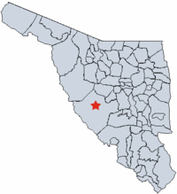
Sonora is subdivided into 72 municipalities (Spanish: municipios), each headed by a municipal president.
Economy
As of 2005, Sonora’s economy represents 2.8% of Mexico’s total gross domestic product or 18,284 million USD.[7] Sonora's economy has a strong focus on export oriented manufacturing (i.e. maquiladora / INMEX). As of 2005, 181,277 people are employed in the manufacturing sector.[8] There are a more than 213 companies operating under the federal INMEX or Prosec program in Sonora. The average wage for an employee in Sonora is approximately 174 pesos per day.
With a GDP per capita of US$10,534, Sonora ranks ninth among Mexican states.
Transportation
Highways
Intercity Bus
Several companies offer low, mid and luxury class bus services between virtually all towns and cities in Sonora, to the rest of Mexico, and international destinations such as Tucson, Phoenix and Los Angeles in the United States.
Airports
Sonora has six international airports; however, one of them, Álamos International Airport (XAL) in the colonial town of Álamos, lacks commercial flights. Airports with regular commercial flights include:
- General Ignacio Pesqueira Garcia International Airport (HMO) in Hermosillo
- Ciudad Obregón International Airport (CEN) in Ciudad Obregón
- General José María Yáñez International Airport (GYM) in Guaymas
- Nogales International Airport (NOG) in Nogales
- Puerto Peñasco International Airport (PPE) in Puerto Peñasco (Rocky Point)
Most towns have paved or dirt runways for private planes. These general aviation airports include:
- Navojoa Airport in Navojoa
- San Luis Río Colorado Airport in San Luis Río Colorado
Tourism
Sonora is a premier tourist destination, especially for visitors from neighboring Arizona.
Recently, Sonora has experienced a boom in tourism, especially in the city of Puerto Peñasco, due to its being the nearest beach to many population centers in Arizona.
People
- Abelardo L. Rodríguez. Former President of Mexico (1932–34).
- Álvaro Obregón. Former President of Mexico (1920–24).
- Plutarco Elías Calles. Former President of Mexico (1924–28).
- Adolfo de la Huerta. Former President of Mexico (1920).
- Bill Melendez
- Ramón Corral
- Jesús García Corona "Héroe de Nacozari".
- José María Leyva "El Indio Cajeme". 19th Century Yaqui warrior and resistance fighter.
- Félix María Zuloaga. Former President of Mexico (1858, 1859, 1860–62)
Fictional portrayals
- Roberto Bolaño's novel 2666 largely takes place in the fictional city of Santa Teresa in the state of Sonora.
- In the Harry Turtledove novel How Few Remain, Sonora is annexed into a fictional Confederate States of America in the 1880s. In all eleven novels of the timeline-191 series, Sonora functions as part of the Confederacy.
- Fighting video game Art of Fighting 3: The Path of the Warrior is set in a fictional town in Sonora named Glasshill (the English name is due to its location being at the country border, even though it seems to lead out into the Sea of Cortez).
Notes
- ↑ "La diputación provincial y el federalismo mexicano" (in Spanish). http://books.google.com.mx/books?id=i_GK_-6deKIC&pg=PA227&lpg=PA227&dq=22+De+Mayo+De+1824+durango&source=bl&ots=eyvDzsrMIz&sig=zYxzmtG7gTQgGV-WNDfHgqcG_kU&hl=es&ei=FtAxS9joN56ltgf-_ojFDg&sa=X&oi=book_result&ct=result&resnum=1&ved=0CAgQ6AEwAA#v=onepage&q=22%20De%20Mayo%20De%201824%20durango&f=false.
- ↑ Eric Hobsbawm, The Age of Empire, 1875-1914, Pg. 289
- ↑ Enrique Krauze, Mexico: A Biography of Power, p. 482
- ↑ Schiavone Camacho, Julia Maria (November 2009). "Crossing Boundaries, Claiming a Homeland: The Mexican Chinese Transpacific Journey to Becoming Mexican, 1930s-1960s". Pacific Historical Review (Berkeley) 78 (4): 547-565.
- ↑ Population map of the state of Sonora, Mexico
- ↑ Escuela Normal del Estado
- ↑ Industrial Costs in Mexico - A Guide for Foreign Investors 2007. Mexico City: Bancomext. 2007. p. 100.
- ↑ Industrial Costs in Mexico - A Guide for Foreign Investors 2007. Mexico City: Bancomext. 2007. p. 100.
External links
- (Spanish) Official Sonora State Government website
|
||||||||||

